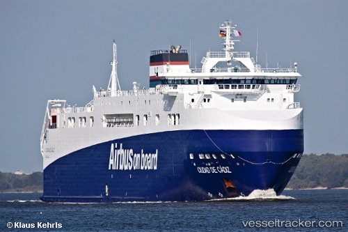
Ciudad De Cadiz
Current StatusWhere is the vessel?
Ciudad De Cadiz is currently in Near Donges, based on AIS data received about 14h ago.
Latest AIS update:
Current position: 47.30510° N, 2.11022° W (Near Donges)
Average speed (last 7 days): Loading…
Average speed (last 30 days): Loading…
Vessel profile: Ciudad De Cadiz is a Ro Ro Cargo Ship with dimensions 25m x 125m.
This page combines live AIS, route history, probable destination signals, nearby traffic, and port activity for practical vessel monitoring.
The current position of vessel Ciudad De Cadiz is 47.30510 lat / -2.11022 lng. Updated: 2026-05-23 14:00:32 UTCNearest reference points:
- Near Arzal
- Near Camoël
- Near LE CROISIC
Details:
Live Vessel Ciudad De Cadiz Analytics (details, animations, etc.)
Recent AIS points (UTC):
2026-05-23 11:14:27 UTC · 47.30508, -2.11024 · SOG 0 kn · COG -1°2026-05-23 11:37:56 UTC · 47.30508, -2.11022 · SOG 0 kn · COG -1°
2026-05-23 13:39:07 UTC · 47.30511, -2.11023 · SOG 0 kn · COG -1°
2026-05-23 14:00:32 UTC · 47.30510, -2.11022 · SOG 0 kn · COG -1°