 vesseltracker.com
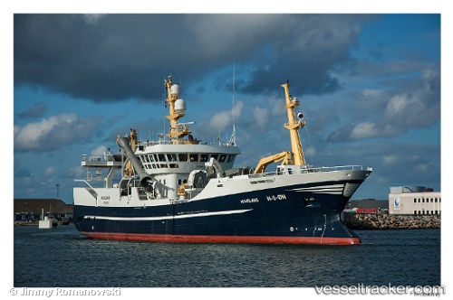
 Havglans
Current Status
Where is the vessel?
Havglans is currently in Near SIREVAG, based on AIS data received less than 1h ago.
Latest AIS update:
Current position: 58.46771° N, 5.74968° E (Near SIREVAG)
Average speed (last 7 days): Loading…
Average speed (last 30 days): Loading…
Vessel profile: Havglans is a Fish Carrier with dimensions 62m x 13m.
This page combines live AIS, route history, probable destination signals, nearby traffic, and port activity for practical vessel monitoring.
The current position of vessel Havglans is 58.46771 lat / 5.74968 lng. Updated: 2026-04-26 03:22:03 UTCNearest reference points:
- Near Egersund
- Near Lura
- Near Åna-Sira
Currently sailing under the flag of Norway ![]()
Havglans built in 2007 year
Deadweight:
1500 tDetails:
Live Vessel Havglans Analytics (details, animations, etc.)
Recent AIS points (UTC):
2026-04-26 00:08:02 UTC · 58.06406, 6.56231 · SOG 10.5 kn · COG 314°2026-04-26 01:09:12 UTC · 58.20338, 6.33608 · SOG 11 kn · COG 312°
2026-04-26 01:32:42 UTC · 58.25148, 6.23253 · SOG 11.3 kn · COG 309°
2026-04-26 03:22:03 UTC · 58.46771, 5.74968 · SOG 11 kn · COG 334°