 vesseltracker.com
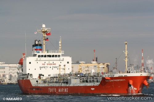
 MARINA PROSPERITY
Current Status
Where is the vessel?
MARINA PROSPERITY is currently in Near Aberdeen, based on AIS data received about 1h ago.
Latest AIS update:
Current position: 22.16498° N, 114.14324° E (Near Aberdeen)
Average speed (last 7 days): Loading…
Average speed (last 30 days): Loading…
Vessel profile: MARINA PROSPERITY is a Oil/Chemical Tanker with dimensions m x m.
This page combines live AIS, route history, probable destination signals, nearby traffic, and port activity for practical vessel monitoring.
The current position of vessel MARINA PROSPERITY is 22.16498 lat / 114.14324 lng. Updated: 2026-05-02 17:50:26 UTCNearest reference points:
- Near Pok Fu Lam
- Near WAILINGDING ISLAND
- Near Tai Tam
Currently sailing under the flag of Panama ![]()
Details:
Live Vessel MARINA PROSPERITY Analytics (details, animations, etc.)
Recent AIS points (UTC):
2026-05-02 13:48:41 UTC · 22.12122, 114.62699 · SOG 12 kn · COG 269°2026-05-02 15:53:29 UTC · 22.13169, 114.22628 · SOG 7.1 kn · COG 279°
2026-05-02 16:34:20 UTC · 22.15340, 114.15055 · SOG 5.5 kn · COG 327°
2026-05-02 17:50:26 UTC · 22.16498, 114.14324 · SOG 0 kn · COG 340°