 vesseltracker.com
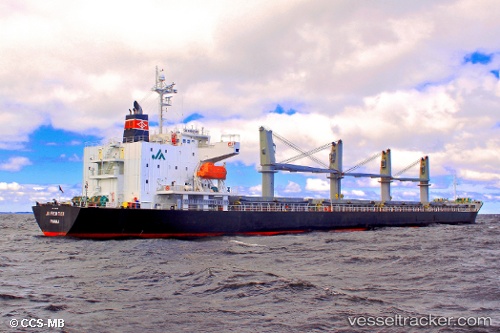
 Emerald Bay
Current Status
Where is the vessel?
Emerald Bay is currently in 48 nm W of Hougharry and Loch Eport, based on AIS data received less than 1h ago.
Latest AIS update:
Current position: 57.45167° N, 9.01667° W (48 nm W of Hougharry and Loch Eport)
Average speed (last 7 days): Loading…
Average speed (last 30 days): Loading…
Vessel profile: Emerald Bay is a Bulk Carrier with dimensions 177m x 28m.
This page combines live AIS, route history, probable destination signals, nearby traffic, and port activity for practical vessel monitoring.
The current position of vessel Emerald Bay is 57.45167 lat / -9.01667 lng. Updated: 2026-05-15 05:56:06 UTCNearest reference points:
- Near North Harris
Currently sailing under the flag of United Kingdom ![]()
Emerald Bay built in 2008 year
Deadweight:
32258 tDetails:
Live Vessel Emerald Bay Analytics (details, animations, etc.)
Recent AIS points (UTC):
2026-05-15 01:12:28 UTC · 57.98267, -7.70555 · SOG 12.5 kn · COG 213°2026-05-15 03:45:28 UTC · 57.59085, -8.27390 · SOG 11.4 kn · COG 251°
2026-05-15 05:05:00 UTC · 57.50333, -8.72333 · SOG 11 kn · COG -1°
2026-05-15 05:56:06 UTC · 57.45167, -9.01667 · SOG 11 kn · COG -1°