 vesseltracker.com
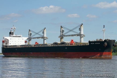
Momi Arrow
Current StatusWhere is the vessel?
Momi Arrow is currently in Open sea (no nearby ports in database), based on AIS data received less than 1h ago.
Latest AIS update:
Current position: 35.64500° N, 149.96623° W (Open sea (no nearby ports in database))
Average speed (last 7 days): Loading…
Average speed (last 30 days): Loading…
Vessel profile: Momi Arrow is a General Cargo Ship with dimensions 32m x 190m.
This page combines live AIS, route history, probable destination signals, nearby traffic, and port activity for practical vessel monitoring.
The current position of vessel Momi Arrow is 35.64500 lat / -149.96623 lng. Updated: 2026-05-16 15:28:34 UTCNearest reference points:
- Open sea (no nearby ports in database)
Details:
Live Vessel Momi Arrow Analytics (details, animations, etc.)
Recent AIS points (UTC):
2026-05-16 12:03:17 UTC · 35.80827, -150.66365 · SOG 10 kn · COG 106°2026-05-16 13:05:37 UTC · 35.76393, -150.45071 · SOG 10.5 kn · COG 107°
2026-05-16 13:20:25 UTC · 35.75352, -150.39975 · SOG 10.2 kn · COG 106°
2026-05-16 15:28:34 UTC · 35.64500, -149.96623 · SOG 10.6 kn · COG 108°