 vesseltracker.com
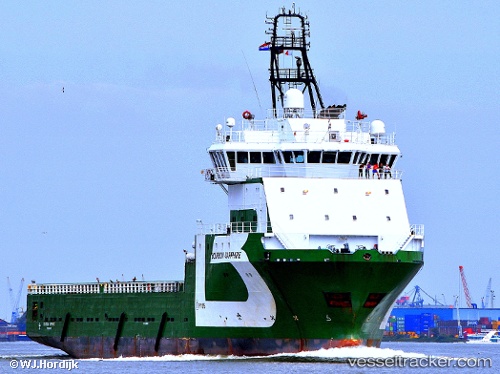
 BOURBON SAPPHIRE
Current Status
Where is the vessel?
BOURBON SAPPHIRE is currently in Near Georgetown, based on AIS data received about 1h ago.
Latest AIS update:
Current position: 6.81667° N, 58.17667° W (Near Georgetown)
Average speed (last 7 days): Loading…
Average speed (last 30 days): Loading…
Vessel profile: BOURBON SAPPHIRE is a Offshore Supply Ship with dimensions 19m x 91m.
This page combines live AIS, route history, probable destination signals, nearby traffic, and port activity for practical vessel monitoring.
The current position of vessel BOURBON SAPPHIRE is 6.81667 lat / -58.17667 lng. Updated: 2026-04-28 05:30:50 UTCNearest reference points:
- 57 nm NE of Adventure
- 38 nm NW of Jarikaba
Currently sailing under the flag of Bahamas ![]()
BOURBON SAPPHIRE built in 2008 year
Deadweight:
4678 tDetails:
Live Vessel BOURBON SAPPHIRE Analytics (details, animations, etc.)
Recent AIS points (UTC):
2026-04-28 01:48:49 UTC · 6.81667, -58.17667 · SOG 0 kn · COG -1°2026-04-28 03:27:52 UTC · 6.81667, -58.17667 · SOG 0 kn · COG -1°
2026-04-28 04:06:51 UTC · 6.81667, -58.17667 · SOG 0 kn · COG -1°
2026-04-28 05:30:50 UTC · 6.81667, -58.17667 · SOG 0 kn · COG -1°