 vesseltracker.com
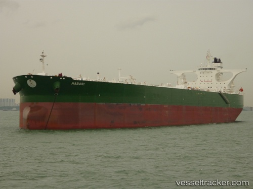
 HABARI
Current Status
Where is the vessel?
HABARI is currently in 48 nm SW of Al Muajjiz, based on AIS data received less than 1h ago.
Latest AIS update:
Current position: 22.97141° N, 37.70536° E (48 nm SW of Al Muajjiz)
Average speed (last 7 days): Loading…
Average speed (last 30 days): Loading…
Vessel profile: HABARI is a Crude Oil Tanker with dimensions 333m x 60m.
This page combines live AIS, route history, probable destination signals, nearby traffic, and port activity for practical vessel monitoring.
The current position of vessel HABARI is 22.97141 lat / 37.70536 lng. Updated: 2026-04-28 05:41:19 UTCNearest reference points:
- 30 nm SW of Yanbu
- 95 nm SW of Al Muajjiz
- 74 nm SW of Yanbu
Currently sailing under the flag of Saudi Arabia ![]()
HABARI built in 2008 year
Deadweight:
317664 tDetails:
Live Vessel HABARI Analytics (details, animations, etc.)
Recent AIS points (UTC):
2026-04-27 20:05:17 UTC · 23.20696, 37.80778 · SOG 1.5 kn · COG 264°2026-04-28 04:21:59 UTC · 22.93412, 37.70325 · SOG 2.4 kn · COG 251°
2026-04-28 04:39:28 UTC · 22.92260, 37.69859 · SOG 2.4 kn · COG 248°
2026-04-28 05:41:19 UTC · 22.97141, 37.70536 · SOG 9.6 kn · COG 16°