 vesseltracker.com
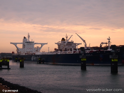
 KAHLA
KAHLA
Current Status
Where is the vessel?
KAHLA is currently in 91 nm S of Nagercoil, based on AIS data received about 2h ago.
Latest AIS update:
Current position: 6.66472° N, 77.21240° E (91 nm S of Nagercoil)
Average speed (last 7 days): Loading…
Average speed (last 30 days): Loading…
Vessel profile: KAHLA is a Crude Oil Tanker with dimensions 333m x 60m.
This page combines live AIS, route history, probable destination signals, nearby traffic, and port activity for practical vessel monitoring.
The current position of vessel KAHLA is 6.66472 lat / 77.21240 lng. Updated: 2026-05-15 00:55:23 UTCNearest reference points:
- 91 nm S of Nagercoil
- 98 nm S of Nagercoil
- 41 nm S of Nagercoil
Currently sailing under the flag of Saudi Arabia ![]()
KAHLA built in 2009 year
Deadweight:
317521 tDetails:
Live Vessel KAHLA Analytics (details, animations, etc.)
Recent AIS points (UTC):
2026-05-14 21:16:43 UTC · 6.41468, 78.02840 · SOG 14.1 kn · COG 282°2026-05-14 22:24:54 UTC · 6.48717, 77.77317 · SOG 14 kn · COG 286°
2026-05-14 23:53:28 UTC · 6.58972, 77.44435 · SOG 14.1 kn · COG 287°
2026-05-15 00:55:23 UTC · 6.66472, 77.21240 · SOG 14.1 kn · COG 287°