 vesseltracker.com
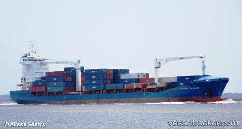
 MEDKON RAY
Current Status
Where is the vessel?
MEDKON RAY is currently in Near Marseille, based on AIS data received about 1h ago.
Latest AIS update:
Current position: 43.34918° N, 5.33356° E (Near Marseille)
Average speed (last 7 days): Loading…
Average speed (last 30 days): Loading…
Vessel profile: MEDKON RAY is a General Cargo with dimensions m x m.
This page combines live AIS, route history, probable destination signals, nearby traffic, and port activity for practical vessel monitoring.
The current position of vessel MEDKON RAY is 43.34918 lat / 5.33356 lng. Updated: 2026-04-23 07:45:19 UTCNearest reference points:
- Near Marseille
- Near Le Canet
- Near LA CIOTAT
Currently sailing under the flag of Panama ![]()
Details:
Live Vessel MEDKON RAY Analytics (details, animations, etc.)
Recent AIS points (UTC):
2026-04-23 04:42:41 UTC · 43.17841, 5.17133 · SOG 7.3 kn · COG 45°2026-04-23 05:45:10 UTC · 43.30851, 5.23993 · SOG 8.5 kn · COG 51°
2026-04-23 07:09:21 UTC · 43.34920, 5.33359 · SOG 0 kn · COG 308°
2026-04-23 07:45:19 UTC · 43.34918, 5.33356 · SOG 0 kn · COG 308°