 vesseltracker.com
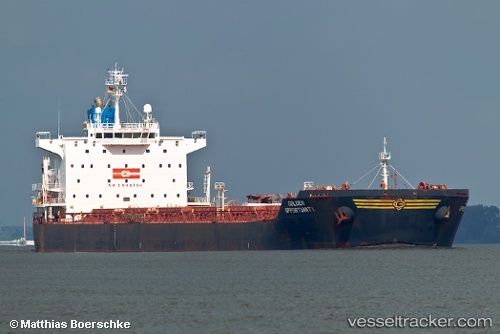
 SANTA MARIA
Current Status
Where is the vessel?
SANTA MARIA is currently in 170 nm NW of Freienbrink, based on AIS data received about 11h ago.
Latest AIS update:
Current position: 55.11108° N, 135.71172° E (170 nm NW of Freienbrink)
Average speed (last 7 days): Loading…
Average speed (last 30 days): Loading…
Vessel profile: SANTA MARIA is a Bulk Carrier with dimensions 225m x 32m.
This page combines live AIS, route history, probable destination signals, nearby traffic, and port activity for practical vessel monitoring.
The current position of vessel SANTA MARIA is 55.11108 lat / 135.71172 lng. Updated: 2026-04-30 14:28:07 UTCCurrently sailing under the flag of Liberia ![]()
SANTA MARIA built in 2008 year
Deadweight:
75825 tDetails:
Live Vessel SANTA MARIA Analytics (details, animations, etc.)
Recent AIS points (UTC):
2026-04-30 14:28:07 UTC · 55.11108, 135.71172 · SOG 0 kn · COG -1°2026-04-30 14:28:07 UTC · 55.11108, 135.71172 · SOG 0 kn · COG -1°
2026-04-30 14:28:07 UTC · 55.11108, 135.71172 · SOG 0 kn · COG -1°
2026-04-30 14:28:07 UTC · 55.11108, 135.71172 · SOG 0 kn · COG -1°