 vesseltracker.com
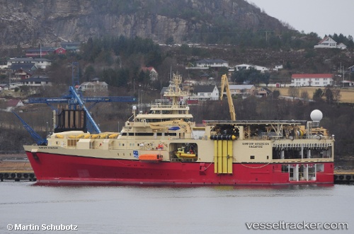
 RAMFORM SOVEREIGN
Current Status
Where is the vessel?
RAMFORM SOVEREIGN is currently in 46 nm E of Senipah Oil Terminal, based on AIS data received less than 1h ago.
Latest AIS update:
Current position: 1.04063° S, 117.99132° E (46 nm E of Senipah Oil Terminal)
Average speed (last 7 days): Loading…
Average speed (last 30 days): Loading…
Vessel profile: RAMFORM SOVEREIGN is a Research/Survey Vessel with dimensions m x m.
This page combines live AIS, route history, probable destination signals, nearby traffic, and port activity for practical vessel monitoring.
The current position of vessel RAMFORM SOVEREIGN is -1.04063 lat / 117.99132 lng. Updated: 2026-05-16 06:05:08 UTCNearest reference points:
- 24 nm E of Handil
- 18 nm E of Senipah Oil Terminal
- 22 nm NE of Handil
Currently sailing under the flag of Norway ![]()
Details:
Live Vessel RAMFORM SOVEREIGN Analytics (details, animations, etc.)
Recent AIS points (UTC):
2026-05-16 02:17:41 UTC · -1.05667, 118.11500 · SOG 4 kn · COG -1°2026-05-16 03:27:47 UTC · -1.14128, 118.10135 · SOG 4.8 kn · COG 233°
2026-05-16 04:44:58 UTC · -1.11048, 118.02114 · SOG 4.4 kn · COG 323°
2026-05-16 06:05:08 UTC · -1.04063, 117.99132 · SOG 3.3 kn · COG 357°