 vesseltracker.com
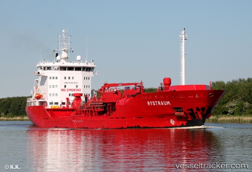
 Rystraum
Current Status
Where is the vessel?
Rystraum is currently in 15 nm SE of Ronehamn, based on AIS data received less than 1h ago.
Latest AIS update:
Current position: 56.94962° N, 18.71359° E (15 nm SE of Ronehamn)
Average speed (last 7 days): Loading…
Average speed (last 30 days): Loading…
Vessel profile: Rystraum is a Chemical Oil Products Tanker with dimensions 129m x 20m.
This page combines live AIS, route history, probable destination signals, nearby traffic, and port activity for practical vessel monitoring.
The current position of vessel Rystraum is 56.94962 lat / 18.71359 lng. Updated: 2026-04-27 19:28:40 UTCNearest reference points:
- 39 nm W of Pilies juru uosto PVP/Klaipeda
- Near WLADYSLAWOWO
- 17 nm W of Gusevka
Currently sailing under the flag of Norway ![]()
Rystraum built in 2009 year
Deadweight:
9597 tDetails:
Live Vessel Rystraum Analytics (details, animations, etc.)
Recent AIS points (UTC):
2026-04-27 16:15:54 UTC · 56.54662, 17.91059 · SOG 11.1 kn · COG 52°2026-04-27 16:46:30 UTC · 56.60453, 18.04570 · SOG 11 kn · COG 51°
2026-04-27 17:38:51 UTC · 56.70367, 18.27640 · SOG 11 kn · COG 50°
2026-04-27 19:28:40 UTC · 56.94962, 18.71359 · SOG 11.5 kn · COG 40°