 vesseltracker.com
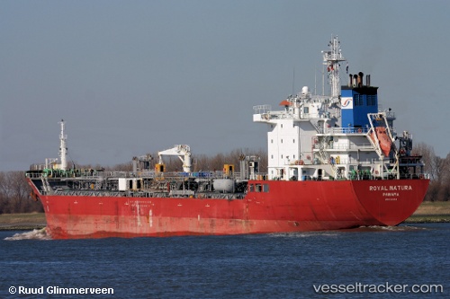
Vale
Current StatusWhere is the vessel?
Vale is currently in Near Belize, based on AIS data received less than 1h ago.
Latest AIS update:
Current position: 17.44549° N, 88.19293° W (Near Belize)
Average speed (last 7 days): Loading…
Average speed (last 30 days): Loading…
Vessel profile: Vale is a Chemical Oil Products Tanker with dimensions 24m x 150m.
This page combines live AIS, route history, probable destination signals, nearby traffic, and port activity for practical vessel monitoring.
The current position of vessel Vale is 17.44549 lat / -88.19293 lng. Updated: 2026-04-29 05:42:55 UTCNearest reference points:
- 14 nm SE of Belize
- 12 nm SW of Dangriga
- 26 nm SE of Dangriga
Details:
Live Vessel Vale Analytics (details, animations, etc.)
Recent AIS points (UTC):
2026-04-29 02:03:55 UTC · 17.44543, -88.19294 · SOG 0 kn · COG 80°2026-04-29 03:51:55 UTC · 17.44565, -88.19295 · SOG 0.1 kn · COG 90°
2026-04-29 04:36:55 UTC · 17.44543, -88.19294 · SOG 0.1 kn · COG 79°
2026-04-29 05:42:55 UTC · 17.44549, -88.19293 · SOG 0 kn · COG 82°