 vesseltracker.com
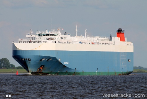
 Serenity Ace
Current Status
Where is the vessel?
Serenity Ace is currently in 336 nm W of Wake Island, based on AIS data received less than 1h ago.
Latest AIS update:
Current position: 18.01597° N, 160.82942° E (336 nm W of Wake Island)
Average speed (last 7 days): Loading…
Average speed (last 30 days): Loading…
Vessel profile: Serenity Ace is a Vehicles Carrier with dimensions 200m x 32m.
This page combines live AIS, route history, probable destination signals, nearby traffic, and port activity for practical vessel monitoring.
The current position of vessel Serenity Ace is 18.01597 lat / 160.82942 lng. Updated: 2026-05-15 12:16:19 UTCNearest reference points:
- Open sea, approx. 402 nm off the nearest listed port
- Open sea, approx. 420 nm off the nearest listed port
- Open sea (no nearby ports in database)
Currently sailing under the flag of Bahamas ![]()
Serenity Ace built in 2008 year
Deadweight:
21004 tDetails:
Live Vessel Serenity Ace Analytics (details, animations, etc.)
Recent AIS points (UTC):
2026-05-15 07:44:40 UTC · 17.32743, 162.11815 · SOG 18.8 kn · COG 297°2026-05-15 09:22:08 UTC · 17.56033, 161.64510 · SOG 18.4 kn · COG 297°
2026-05-15 10:32:01 UTC · 17.74160, 161.31740 · SOG 19 kn · COG 304°
2026-05-15 12:16:19 UTC · 18.01597, 160.82942 · SOG 18.4 kn · COG 300°