 vesseltracker.com
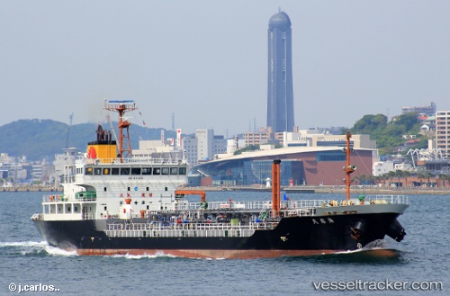
Kaiyu Maru
Current StatusWhere is the vessel?
Kaiyu Maru is currently in Near Ube, based on AIS data received less than 1h ago.
Latest AIS update:
Current position: 33.89827° N, 131.17622° E (Near Ube)
Average speed (last 7 days): Loading…
Average speed (last 30 days): Loading…
Vessel profile: Kaiyu Maru is a Oil Products Tanker with dimensions 16m x 104m.
This page combines live AIS, route history, probable destination signals, nearby traffic, and port activity for practical vessel monitoring.
The current position of vessel Kaiyu Maru is 33.89827 lat / 131.17622 lng. Updated: 2026-05-01 22:12:29 UTCNearest reference points:
- Near Ube
- Near KANDA
- Near Shimonoseki
Details:
Live Vessel Kaiyu Maru Analytics (details, animations, etc.)
Recent AIS points (UTC):
2026-05-01 19:33:34 UTC · 33.89754, 131.17638 · SOG 0 kn · COG 48°2026-05-01 19:58:08 UTC · 33.89667, 131.17500 · SOG 0 kn · COG -1°
2026-05-01 22:02:19 UTC · 33.89827, 131.17619 · SOG 0 kn · COG 104°
2026-05-01 22:12:29 UTC · 33.89827, 131.17622 · SOG 0 kn · COG 107°