 vesseltracker.com
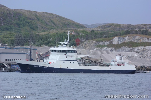
 Ronja Harvester
Current Status
Where is the vessel?
Ronja Harvester is currently in Near PATREKSFJORDUR, based on AIS data received less than 1h ago.
Latest AIS update:
Current position: 65.62923° N, 24.07368° W (Near PATREKSFJORDUR)
Average speed (last 7 days): Loading…
Average speed (last 30 days): Loading…
Vessel profile: Ronja Harvester is a Fish Carrier with dimensions 68m x 68m.
This page combines live AIS, route history, probable destination signals, nearby traffic, and port activity for practical vessel monitoring.
The current position of vessel Ronja Harvester is 65.62923 lat / -24.07368 lng. Updated: 2026-04-28 11:35:58 UTCNearest reference points:
- Near FLATEYRI
- Near RIF
- 13 nm E of ISAFJORDUR
Currently sailing under the flag of Norway ![]()
Ronja Harvester built in 2007 year
Deadweight:
2220 tDetails:
Live Vessel Ronja Harvester Analytics (details, animations, etc.)
Recent AIS points (UTC):
2026-04-28 07:58:17 UTC · 65.53081, -23.85725 · SOG 0.1 kn · COG 181°2026-04-28 10:27:46 UTC · 65.63220, -24.13074 · SOG 5.7 kn · COG 359°
2026-04-28 10:54:58 UTC · 65.62346, -24.09361 · SOG 3.4 kn · COG 352°
2026-04-28 11:35:58 UTC · 65.62923, -24.07368 · SOG 0.1 kn · COG 123°