 vesseltracker.com
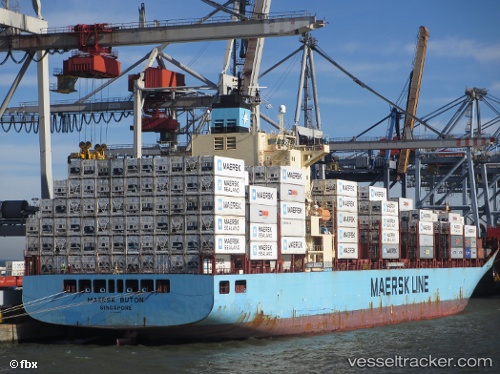
 Maersk Buton
Current Status
Where is the vessel?
Maersk Buton is currently in 294 nm W of Pedernales, based on AIS data received less than 1h ago.
Latest AIS update:
Current position: 2.02273° N, 84.80303° W (294 nm W of Pedernales)
Average speed (last 7 days): Loading…
Average speed (last 30 days): Loading…
Vessel profile: Maersk Buton is a Container Ship with dimensions 223m x 32m.
This page combines live AIS, route history, probable destination signals, nearby traffic, and port activity for practical vessel monitoring.
The current position of vessel Maersk Buton is 2.02273 lat / -84.80303 lng. Updated: 2026-05-02 17:17:17 UTCNearest reference points:
- 208 nm NW of Pedernales
Currently sailing under the flag of Singapore ![]()
Maersk Buton built in 2008 year
Deadweight:
43123 tDetails:
Live Vessel Maersk Buton Analytics (details, animations, etc.)
Recent AIS points (UTC):
2026-05-02 13:42:17 UTC · 1.28729, -85.41550 · SOG 16.3 kn · COG 38°2026-05-02 16:05:26 UTC · 1.78243, -85.00198 · SOG 15.7 kn · COG 35°
2026-05-02 16:40:41 UTC · 1.90167, -84.90333 · SOG 15 kn · COG -1°
2026-05-02 17:17:17 UTC · 2.02273, -84.80303 · SOG 15.9 kn · COG 38°