 vesseltracker.com
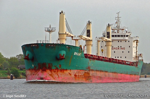
 Brant
Brant
Current Status
Where is the vessel?
Brant is currently in 190 nm SE of Arembepe, based on AIS data received less than 1h ago.
Latest AIS update:
Current position: 14.35833° S, 35.36500° W (190 nm SE of Arembepe)
Average speed (last 7 days): Loading…
Average speed (last 30 days): Loading…
Vessel profile: Brant is a Bulk Carrier with dimensions 185m x 24m.
This page combines live AIS, route history, probable destination signals, nearby traffic, and port activity for practical vessel monitoring.
The current position of vessel Brant is -14.35833 lat / -35.36500 lng. Updated: 2026-05-14 07:36:49 UTCCurrently sailing under the flag of Cyprus ![]()
Brant built in 2008 year
Deadweight:
30776 tDetails:
Live Vessel Brant Analytics (details, animations, etc.)
Recent AIS points (UTC):
2026-05-14 04:03:47 UTC · -13.74500, -35.07167 · SOG 11 kn · COG -1°2026-05-14 06:06:48 UTC · -14.10167, -35.23833 · SOG 11 kn · COG -1°
2026-05-14 07:06:49 UTC · -14.27333, -35.32333 · SOG 11 kn · COG -1°
2026-05-14 07:36:49 UTC · -14.35833, -35.36500 · SOG 11 kn · COG -1°