 vesseltracker.com
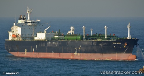
 AL MARYAH
Current Status
Where is the vessel?
AL MARYAH is currently in Near Offshore Fujairah, based on AIS data received about 5d ago.
Latest AIS update:
Current position: 25.27160° N, 56.51695° E (Near Offshore Fujairah)
Average speed (last 7 days): Loading…
Average speed (last 30 days): Loading…
Vessel profile: AL MARYAH is a Lpg Tanker with dimensions m x m.
This page combines live AIS, route history, probable destination signals, nearby traffic, and port activity for practical vessel monitoring.
The current position of vessel AL MARYAH is 25.27160 lat / 56.51695 lng. Updated: 2026-05-10 12:10:41 UTCNearest reference points:
- Near Fujairah
- Near KHORFAKKAN
- Near Offshore Fujairah
Currently sailing under the flag of Liberia ![]()
Details:
Live Vessel AL MARYAH Analytics (details, animations, etc.)
Recent AIS points (UTC):
2026-05-10 12:10:41 UTC · 25.27160, 56.51695 · SOG 0 kn · COG 88°2026-05-10 12:10:41 UTC · 25.27160, 56.51695 · SOG 0 kn · COG 88°
2026-05-10 12:10:41 UTC · 25.27160, 56.51695 · SOG 0 kn · COG 88°
2026-05-10 12:10:41 UTC · 25.27160, 56.51695 · SOG 0 kn · COG 88°