 vesseltracker.com
 Henry Darcy
Current Status
Where is the vessel?
Henry Darcy is currently in Near PASIR PANJANG Terminal, based on AIS data received about 1h ago.
Latest AIS update:
Current position: 1.30051° N, 103.75524° E (Near PASIR PANJANG Terminal)
Average speed (last 7 days): Loading…
Average speed (last 30 days): Loading…
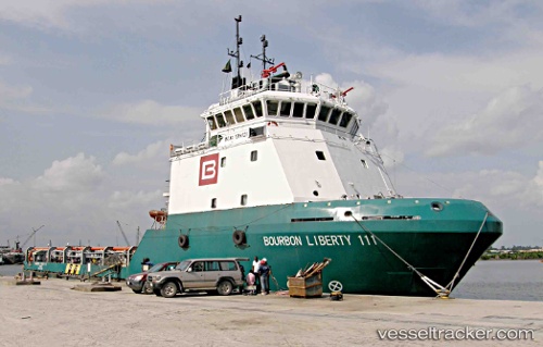
Vessel profile: Henry Darcy is a Offshore Tug Supply Ship with dimensions 58m x 14m.
This page combines live AIS, route history, probable destination signals, nearby traffic, and port activity for practical vessel monitoring.
The current position of vessel Henry Darcy is 1.30051 lat / 103.75524 lng. Updated: 2026-05-16 17:30:58 UTCNearest reference points:
- Near PASIR PANJANG Terminal
- Near Jurong/Singapore
- Near Pasir Panjang Wharves
Currently sailing under the flag of Luxembourg ![]()
Henry Darcy built in 2008 year
Deadweight:
1532 tDetails:
Live Vessel Henry Darcy Analytics (details, animations, etc.)
Recent AIS points (UTC):
2026-05-16 13:52:00 UTC · 1.30051, 103.75524 · SOG 0 kn · COG 338°2026-05-16 15:39:58 UTC · 1.30055, 103.75523 · SOG 0 kn · COG 338°
2026-05-16 16:33:59 UTC · 1.30054, 103.75527 · SOG 0 kn · COG 338°
2026-05-16 17:30:58 UTC · 1.30051, 103.75524 · SOG 0 kn · COG 338°