 vesseltracker.com
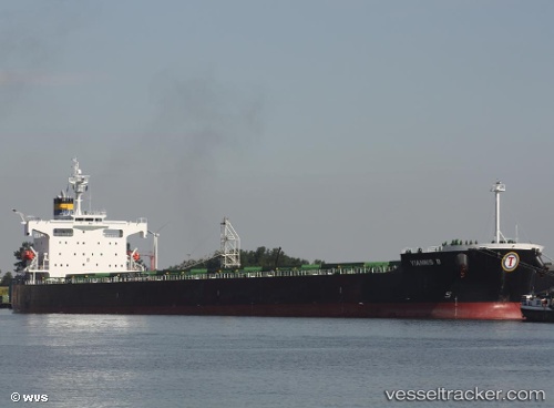
Yiannis B
Current StatusWhere is the vessel?
Yiannis B is currently in 112 nm E of Sapiranga, based on AIS data received less than 1h ago.
Latest AIS update:
Current position: 30.24670° S, 23.04791° W (112 nm E of Sapiranga)
Average speed (last 7 days): Loading…
Average speed (last 30 days): Loading…
Vessel profile: Yiannis B is a Bulk Carrier with dimensions 32m x 229m.
This page combines live AIS, route history, probable destination signals, nearby traffic, and port activity for practical vessel monitoring.
The current position of vessel Yiannis B is -30.24670 lat / -23.04791 lng. Updated: 2026-05-14 12:05:03 UTCDetails:
Live Vessel Yiannis B Analytics (details, animations, etc.)
Recent AIS points (UTC):
2026-05-14 08:03:03 UTC · -29.95219, -23.75085 · SOG 10.2 kn · COG 117°2026-05-14 10:13:14 UTC · -30.11059, -23.36675 · SOG 9.9 kn · COG 117°
2026-05-14 10:15:42 UTC · -30.11357, -23.35955 · SOG 10 kn · COG 116°
2026-05-14 12:05:03 UTC · -30.24670, -23.04791 · SOG 9.7 kn · COG 118°