 vesseltracker.com
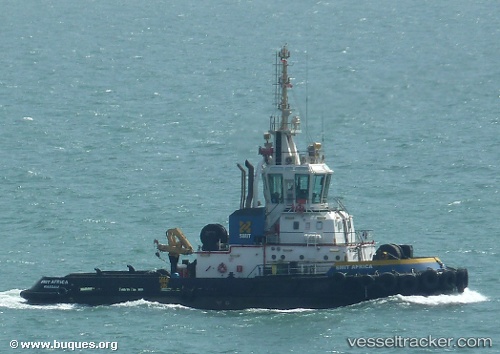
 SL AFRICA
Current Status
Where is the vessel?
SL AFRICA is currently in Near Futila Terminal, based on AIS data received less than 1h ago.
Latest AIS update:
Current position: 5.40229° S, 12.17022° E (Near Futila Terminal)
Average speed (last 7 days): Loading…
Average speed (last 30 days): Loading…
Vessel profile: SL AFRICA is a Tug with dimensions 24m x 40m.
This page combines live AIS, route history, probable destination signals, nearby traffic, and port activity for practical vessel monitoring.
The current position of vessel SL AFRICA is -5.40229 lat / 12.17022 lng. Updated: 2026-04-28 19:28:32 UTCNearest reference points:
- Near Futila Terminal
- 11 nm W of Cabinda
- Near N'Kossa Terminal
Currently sailing under the flag of Cyprus ![]()
SL AFRICA built in 2007 year
Deadweight:
0 tDetails:
Live Vessel SL AFRICA Analytics (details, animations, etc.)
Recent AIS points (UTC):
2026-04-28 16:07:32 UTC · -5.40241, 12.17047 · SOG 0 kn · COG 187°2026-04-28 16:49:27 UTC · -5.40237, 12.17037 · SOG 0.1 kn · COG 202°
2026-04-28 18:19:24 UTC · -5.40234, 12.17029 · SOG 0 kn · COG -1°
2026-04-28 19:28:32 UTC · -5.40229, 12.17022 · SOG 0.1 kn · COG -1°