 vesseltracker.com
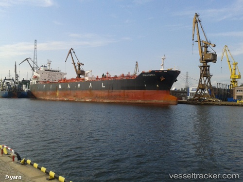
 SKYLIGHT
Current Status
Where is the vessel?
SKYLIGHT is currently in Near Tema, based on AIS data received about 1h ago.
Latest AIS update:
Current position: 5.64998° N, 0.07100° E (Near Tema)
Average speed (last 7 days): Loading…
Average speed (last 30 days): Loading…
Vessel profile: SKYLIGHT is a Chemical Oil Products Tanker with dimensions 32m x 183m.
This page combines live AIS, route history, probable destination signals, nearby traffic, and port activity for practical vessel monitoring.
The current position of vessel SKYLIGHT is 5.64998 lat / 0.07100 lng. Updated: 2026-04-29 20:12:21 UTCNearest reference points:
- Near Ablogamé
- Near Sekondi
- Near Takoradi
Currently sailing under the flag of Marshall Is ![]()
SKYLIGHT built in 0 year
Deadweight:
0 tDetails:
Live Vessel SKYLIGHT Analytics (details, animations, etc.)
Recent AIS points (UTC):
2026-04-29 16:06:53 UTC · 5.64997, 0.07103 · SOG 0 kn · COG 179°2026-04-29 18:24:20 UTC · 5.64996, 0.07098 · SOG 0 kn · COG 178°
2026-04-29 19:27:19 UTC · 5.64997, 0.07105 · SOG 0 kn · COG 179°
2026-04-29 20:12:21 UTC · 5.64998, 0.07100 · SOG 0 kn · COG 178°