 vesseltracker.com
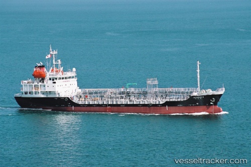
Nuri Hana
Current StatusWhere is the vessel?
Nuri Hana is currently in Near Shima, Mie, based on AIS data received less than 1h ago.
Latest AIS update:
Current position: 34.34500° N, 136.96333° E (Near Shima, Mie)
Average speed (last 7 days): Loading…
Average speed (last 30 days): Loading…
Vessel profile: Nuri Hana is a Chemical Oil Products Tanker with dimensions 13m x 84m.
This page combines live AIS, route history, probable destination signals, nearby traffic, and port activity for practical vessel monitoring.
The current position of vessel Nuri Hana is 34.34500 lat / 136.96333 lng. Updated: 2026-05-14 04:14:43 UTCNearest reference points:
- 12 nm E of TOBA
- Near TOBA
- Near Atumi
Details:
Live Vessel Nuri Hana Analytics (details, animations, etc.)
Recent AIS points (UTC):
2026-05-14 01:42:43 UTC · 33.96777, 136.55515 · SOG 12.6 kn · COG 55°2026-05-14 01:42:43 UTC · 33.96777, 136.55515 · SOG 12.6 kn · COG 55°
2026-05-14 03:38:43 UTC · 34.23167, 136.91667 · SOG 11 kn · COG -1°
2026-05-14 04:14:43 UTC · 34.34500, 136.96333 · SOG 12 kn · COG -1°