 vesseltracker.com
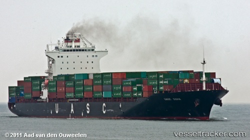
 Eleni T
Current Status
Where is the vessel?
Eleni T is currently in Near KHORFAKKAN, based on AIS data received about 1h ago.
Latest AIS update:
Current position: 25.35439° N, 56.36526° E (Near KHORFAKKAN)
Average speed (last 7 days): Loading…
Average speed (last 30 days): Loading…
Vessel profile: Eleni T is a Container Ship with dimensions 260m x 32m.
This page combines live AIS, route history, probable destination signals, nearby traffic, and port activity for practical vessel monitoring.
The current position of vessel Eleni T is 25.35439 lat / 56.36526 lng. Updated: 2026-05-14 06:10:38 UTCNearest reference points:
- Near KHORFAKKAN
- Near Fujairah
- Near Offshore Fujairah
Currently sailing under the flag of Marshall Is ![]()
Eleni T built in 2009 year
Deadweight:
50700 tDetails:
Live Vessel Eleni T Analytics (details, animations, etc.)
Recent AIS points (UTC):
2026-05-14 02:54:24 UTC · 25.35402, 56.36530 · SOG 0.8 kn · COG 151°2026-05-14 03:50:04 UTC · 25.35436, 56.36532 · SOG 0 kn · COG 151°
2026-05-14 04:59:40 UTC · 25.35438, 56.36523 · SOG 0.2 kn · COG 151°
2026-05-14 06:10:38 UTC · 25.35439, 56.36526 · SOG 0.6 kn · COG 151°