 vesseltracker.com
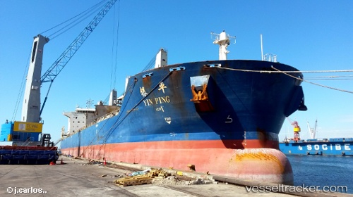
Yin Ping
Current StatusWhere is the vessel?
Yin Ping is currently in Near Chongming, based on AIS data received less than 1h ago.
Latest AIS update:
Current position: 31.53401° N, 121.38187° E (Near Chongming)
Average speed (last 7 days): Loading…
Average speed (last 30 days): Loading…
Vessel profile: Yin Ping is a Bulk Carrier with dimensions 32m x 190m.
This page combines live AIS, route history, probable destination signals, nearby traffic, and port activity for practical vessel monitoring.
The current position of vessel Yin Ping is 31.53401 lat / 121.38187 lng. Updated: 2026-05-13 21:23:30 UTCNearest reference points:
- Near Chongming
- Near Baoshan Pt
- Near Jiading
Details:
Live Vessel Yin Ping Analytics (details, animations, etc.)
Recent AIS points (UTC):
2026-05-13 17:30:49 UTC · 31.92616, 120.87104 · SOG 10 kn · COG 157°2026-05-13 19:35:10 UTC · 31.66330, 121.20523 · SOG 13.4 kn · COG 129°
2026-05-13 19:59:51 UTC · 31.60171, 121.28209 · SOG 12.2 kn · COG 139°
2026-05-13 21:23:30 UTC · 31.53401, 121.38187 · SOG 1.7 kn · COG 338°