 vesseltracker.com
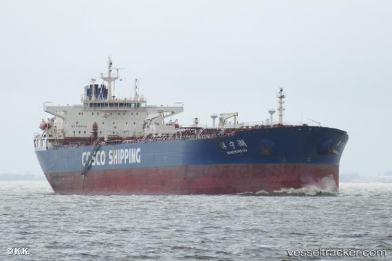
Yang Ning Hu
Current StatusWhere is the vessel?
Yang Ning Hu is currently in 57 nm SE of Hettimulla, based on AIS data received less than 1h ago.
Latest AIS update:
Current position: 6.41343° N, 79.65322° W (57 nm SE of Hettimulla)
Average speed (last 7 days): Loading…
Average speed (last 30 days): Loading…
Vessel profile: Yang Ning Hu is a Oil Products Tanker with dimensions 42m x 245m.
This page combines live AIS, route history, probable destination signals, nearby traffic, and port activity for practical vessel monitoring.
The current position of vessel Yang Ning Hu is 6.41343 lat / -79.65322 lng. Updated: 2026-05-17 20:10:05 UTCNearest reference points:
- 30 nm E of El Cirial (Isla Iguana)
- 20 nm S of El Puerto
- Near Saboga
Details:
Live Vessel Yang Ning Hu Analytics (details, animations, etc.)
Recent AIS points (UTC):
2026-05-17 16:11:02 UTC · 6.24847, -79.59713 · SOG 10.5 kn · COG 320°2026-05-17 17:09:11 UTC · 6.37122, -79.72790 · SOG 7.8 kn · COG 351°
2026-05-17 19:36:27 UTC · 6.41767, -79.65755 · SOG 1 kn · COG 108°
2026-05-17 20:10:05 UTC · 6.41343, -79.65322 · SOG 0.3 kn · COG 131°