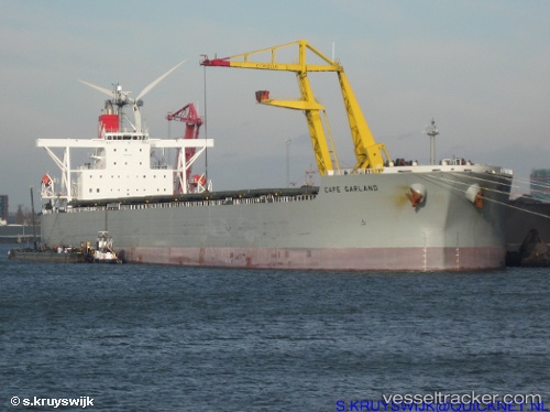
.
Vessel photo of WEN HUA STAR (IMO 9397846) vesseltracker.com

LB flag WEN HUA STAR

Vessel type: Bulk Carrier | IMO: 9397846 | MMSI: MMSI: 636021300
Call sign: 5LDG8 | Dimensions: 44 m x 292 m
Current Status

Where is the vessel?

WEN HUA STAR is currently in 11 nm W of Skardon River, based on AIS data received about 2h ago.

Latest AIS update:

Current position: 11.75780° S, 141.82965° E (11 nm W of Skardon River)

Average speed (last 7 days): Loading…

Average speed (last 30 days): Loading…

Vessel profile: WEN HUA STAR is a Bulk Carrier with dimensions 44m x 292m.

This page combines live AIS, route history, probable destination signals, nearby traffic, and port activity for practical vessel monitoring.

The current position of vessel WEN HUA STAR is -11.75780 lat / 141.82965 lng. Updated: 2026-03-25 15:28:43 UTC
Nearest reference points:
  • Near Torres Strait
  • Near Thursday Island

Currently sailing under the flag of Liberia LB flag

WEN HUA STAR built in 2009 year

Deadweight:
178394 t

Details:

Live Vessel WEN HUA STAR Analytics (details, animations, etc.)


Recent AIS points (UTC):
2026-03-25 09:40:37 UTC · -11.75507, 141.83025 · SOG 0 kn · COG 118°
2026-03-25 10:43:36 UTC · -11.75625, 141.82954 · SOG 0.1 kn · COG 106°
2026-03-25 14:01:34 UTC · -11.75847, 141.82996 · SOG 0 kn · COG 53°
2026-03-25 15:28:43 UTC · -11.75780, 141.82965 · SOG 0 kn · COG 76°

Track of the vessel in the last 28 days


UTC: --
Start: -- Track timeline (UTC) End: --
Encountered: --


Link to the map:


Find another ship

WEN_HUA_STAR (636021300) last ports (portcalls and passsages)

BUKOM ISLAND | 2025-07-09 22:43:20
PULAU SAMBU | 2025-07-09 21:42:43
BATU AMPAR | 2025-07-09 21:01:53
TANAH MERAH | 2025-07-08 13:41:38
PENGERANG | 2025-07-08 12:25:11
DONGJIAKOU | 2025-06-25 09:14:18
Fangcheng | 2025-05-08 17:35:51
SURALAYA | 2025-04-30 05:26:15
JURONG ISLAND | 2024-12-16 13:01:34
BUKOM ISLAND | 2024-12-16 12:04:49
TANAH MERAH | 2024-12-15 17:48:47
PENGERANG | 2024-12-15 16:26:32
HUANGHUA | 2024-12-01 07:25:13
Singapore | 2024-07-30 04:13:08
Dagu Bar | 2024-07-19 00:11:28
Ta-Ku | 2024-07-18 00:53:02
Ta-Ku | 2024-07-14 00:27:58
Taku Bar | 2024-07-13 21:13:06
Selat Lombok | 2024-05-22 21:04:02
Dampier | 2024-05-18 02:45:47
Sambu | 2024-02-01 17:53:20
Selat Lombok | 2024-01-12 06:01:42
Nassau | 2024-01-08 15:11:59
Nassau | 2024-01-03 14:25:53
Nassau | 2023-12-29 14:20:31
Nassau | 2023-12-23 18:19:45
Nassau | 2023-12-19 17:24:50
Singapore | 2023-07-28 19:35:22
Qingdao | 2023-05-29 21:33:53
Basuo Gang | 2023-04-21 19:25:45
Nassau | 2023-01-01 20:57:18
Nassau | 2022-12-28 05:39:58
Nassau | 2022-12-22 14:28:16
Nassau | 2022-11-30 05:45:20
Freeport | 2022-10-17 16:32:40
Freeport | 2022-10-12 14:04:12
Freeport | 2022-10-08 13:46:45
Freeport | 2022-10-04 11:06:44
Freeport | 2022-09-30 10:17:06
Freeport | 2022-09-26 10:10:14
Freeport | 2022-09-22 08:03:04
Freeport | 2022-09-18 07:57:21
Freeport | 2022-09-14 04:14:42
Freeport | 2022-09-10 02:02:37
Freeport | 2022-09-06 01:28:58
Freeport | 2022-08-30 16:16:37
Nassau | 2022-08-12 19:51:58
Nassau | 2022-07-17 10:05:00
Nassau | 2022-06-30 22:32:37
Nassau | 2022-06-26 19:53:52
Nassau | 2022-06-22 16:50:38
Nassau | 2022-06-18 14:00:02
Nassau | 2022-06-14 11:02:06
Nassau | 2022-06-08 01:31:20
Nassau | 2022-06-03 22:41:00
Nassau | 2022-05-12 04:10:46
Yokkaichi | 2021-12-21 01:35:07
Yokosuka | 2021-12-20 08:45:16
Yokosuka | 2021-12-20 08:10:56
Yokohama | 2021-12-20 08:05:55
Yokohama | 2021-12-20 07:55:55
Yokohama | 2021-12-20 07:45:45
Kawasaki | 2021-12-20 07:35:15
Kashima Ko | 2021-12-02 11:39:51