 vesseltracker.com
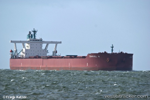
 Daniel N
Current Status
Where is the vessel?
Daniel N is currently in Open sea (no nearby ports in database), based on AIS data received less than 1h ago.
Latest AIS update:
Current position: 15.41117° S, 87.85523° E (Open sea (no nearby ports in database))
Average speed (last 7 days): Loading…
Average speed (last 30 days): Loading…
Vessel profile: Daniel N is a Ore Carrier with dimensions 327m x 55m.
This page combines live AIS, route history, probable destination signals, nearby traffic, and port activity for practical vessel monitoring.
The current position of vessel Daniel N is -15.41117 lat / 87.85523 lng. Updated: 2026-05-17 17:38:19 UTCNearest reference points:
- Open sea (no nearby ports in database)
Currently sailing under the flag of Liberia ![]()
Daniel N built in 2011 year
Deadweight:
297359 tDetails:
Live Vessel Daniel N Analytics (details, animations, etc.)
Recent AIS points (UTC):
2026-05-17 14:12:39 UTC · -15.69917, 87.32063 · SOG 10.4 kn · COG 62°2026-05-17 15:36:59 UTC · -15.58140, 87.53924 · SOG 10.3 kn · COG 64°
2026-05-17 16:38:25 UTC · -15.49584, 87.69896 · SOG 10.5 kn · COG 63°
2026-05-17 17:38:19 UTC · -15.41117, 87.85523 · SOG 10.3 kn · COG 63°