 vesseltracker.com
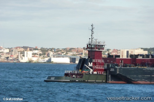
 Linda Moran
Current Status
Where is the vessel?
Linda Moran is currently in 15 nm E of Jensen Beach, based on AIS data received less than 1h ago.
Latest AIS update:
Current position: 27.18833° N, 79.93833° W (15 nm E of Jensen Beach)
Average speed (last 7 days): Loading…
Average speed (last 30 days): Loading…
Vessel profile: Linda Moran is a Pusher Tug with dimensions 156m x 24m.
This page combines live AIS, route history, probable destination signals, nearby traffic, and port activity for practical vessel monitoring.
The current position of vessel Linda Moran is 27.18833 lat / -79.93833 lng. Updated: 2026-05-14 11:19:32 UTCNearest reference points:
- Near Juno Beach
- Near Palm City
- Near Saint Lucie
Currently sailing under the flag of USA ![]()
Linda Moran built in 2008 year
Deadweight:
101 tDetails:
Live Vessel Linda Moran Analytics (details, animations, etc.)
Recent AIS points (UTC):
2026-05-14 08:00:53 UTC · 26.57218, -79.87853 · SOG 12.1 kn · COG 3°2026-05-14 10:22:34 UTC · 27.03847, -79.90804 · SOG 9.8 kn · COG 346°
2026-05-14 10:32:04 UTC · 27.06459, -79.91151 · SOG 10.1 kn · COG 349°
2026-05-14 11:19:32 UTC · 27.18833, -79.93833 · SOG 9 kn · COG -1°