 vesseltracker.com
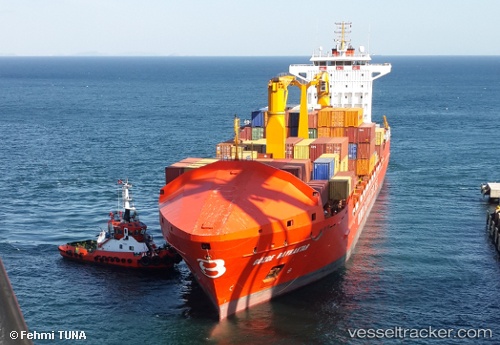
 Gozde Bayraktar
Current Status
Where is the vessel?
Gozde Bayraktar is currently in Near BARBAROS, based on AIS data received less than 1h ago.
Latest AIS update:
Current position: 40.89590° N, 27.46946° E (Near BARBAROS)
Average speed (last 7 days): Loading…
Average speed (last 30 days): Loading…
Vessel profile: Gozde Bayraktar is a Multi Purpose Carrier with dimensions 156m x 24m.
This page combines live AIS, route history, probable destination signals, nearby traffic, and port activity for practical vessel monitoring.
The current position of vessel Gozde Bayraktar is 40.89590 lat / 27.46946 lng. Updated: 2026-05-14 07:22:15 UTCNearest reference points:
- Near TEKIRDAG
- Near Saraylar
- Near Sarköy
Currently sailing under the flag of Turkey ![]()
Gozde Bayraktar built in 2009 year
Deadweight:
22000 tDetails:
Live Vessel Gozde Bayraktar Analytics (details, animations, etc.)
Recent AIS points (UTC):
2026-05-14 03:55:16 UTC · 40.89590, 27.46950 · SOG 0 kn · COG 201°2026-05-14 05:07:15 UTC · 40.89591, 27.46949 · SOG 0 kn · COG 202°
2026-05-14 05:58:15 UTC · 40.89590, 27.46948 · SOG 0 kn · COG 202°
2026-05-14 07:22:15 UTC · 40.89590, 27.46946 · SOG 0 kn · COG 202°