 Dimitris A
Current Status
Where is the vessel?
Dimitris A is currently in 126 nm SW of L'Étang-Salé, based on AIS data received about 14h ago.
Latest AIS update:
Current position: 22.91500° S, 53.95500° E (126 nm SW of L'Étang-Salé)
Average speed (last 7 days): Loading…
Average speed (last 30 days): Loading…
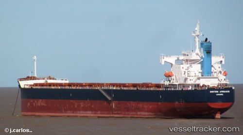
Vessel profile: Dimitris A is a Bulk Carrier with dimensions 230m x 32m.
This page combines live AIS, route history, probable destination signals, nearby traffic, and port activity for practical vessel monitoring.
The current position of vessel Dimitris A is -22.91500 lat / 53.95500 lng. Updated: 2026-05-23 13:59:27 UTCNearest reference points:
- 209 nm E of Manakara
- 129 nm W of Al Azaiba
Currently sailing under the flag of Cyprus ![]()
Dimitris A built in 2008 year
Deadweight:
82518 tDetails:
Live Vessel Dimitris A Analytics (details, animations, etc.)
Recent AIS points (UTC):
2026-05-23 10:33:49 UTC · -22.63243, 54.55688 · SOG 11 kn · COG 237°2026-05-23 11:21:49 UTC · -22.70393, 54.41914 · SOG 11.1 kn · COG 243°
2026-05-23 13:59:27 UTC · -22.91500, 53.95500 · SOG 10 kn · COG -1°
2026-05-23 13:59:27 UTC · -22.91500, 53.95500 · SOG 10 kn · COG -1°