 vesseltracker.com
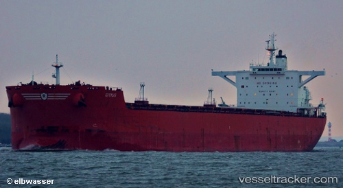
 Citius
Current Status
Where is the vessel?
Citius is currently in Near Maji Shan, based on AIS data received less than 1h ago.
Latest AIS update:
Current position: 30.61098° N, 122.55993° E (Near Maji Shan)
Average speed (last 7 days): Loading…
Average speed (last 30 days): Loading…
Vessel profile: Citius is a Bulk Carrier with dimensions 288m x 45m.
This page combines live AIS, route history, probable destination signals, nearby traffic, and port activity for practical vessel monitoring.
The current position of vessel Citius is 30.61098 lat / 122.55993 lng. Updated: 2026-04-19 16:11:40 UTCNearest reference points:
- Near Lü-hua Shan
- Near Maji Shan
- 14 nm NE of JINHAI HEAVY INDUSTR
Currently sailing under the flag of United Kingdom ![]()
Citius built in 2010 year
Deadweight:
170024 tDetails:
Live Vessel Citius Analytics (details, animations, etc.)
Recent AIS points (UTC):
2026-04-19 13:08:39 UTC · 30.60981, 122.55998 · SOG 0.7 kn · COG 72°2026-04-19 13:38:41 UTC · 30.60984, 122.56007 · SOG 0.5 kn · COG 66°
2026-04-19 15:23:35 UTC · 30.61068, 122.55979 · SOG 0.1 kn · COG 92°
2026-04-19 16:11:40 UTC · 30.61098, 122.55993 · SOG 0.1 kn · COG 97°