 vesseltracker.com
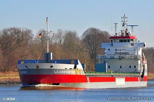
 Lauwersborg
Current Status
Where is the vessel?
Lauwersborg is currently in Near Nevlunghamn, based on AIS data received about 2h ago.
Latest AIS update:
Current position: 58.93794° N, 9.81215° E (Near Nevlunghamn)
Average speed (last 7 days): Loading…
Average speed (last 30 days): Loading…
Vessel profile: Lauwersborg is a Multi Purpose Carrier with dimensions 123m x 14m.
This page combines live AIS, route history, probable destination signals, nearby traffic, and port activity for practical vessel monitoring.
The current position of vessel Lauwersborg is 58.93794 lat / 9.81215 lng. Updated: 2026-05-13 17:26:03 UTCNearest reference points:
- Near Rønningen
- Near Thorøya
- Near SANDEFJORD
Currently sailing under the flag of Netherlands ![]()
Lauwersborg built in 2007 year
Deadweight:
7350 tDetails:
Live Vessel Lauwersborg Analytics (details, animations, etc.)
Recent AIS points (UTC):
2026-05-13 14:23:33 UTC · 58.77608, 10.29506 · SOG 0.4 kn · COG 54°2026-05-13 15:36:52 UTC · 58.77862, 10.27029 · SOG 6.6 kn · COG 299°
2026-05-13 16:33:03 UTC · 58.85685, 10.02536 · SOG 9.9 kn · COG 298°
2026-05-13 17:26:03 UTC · 58.93794, 9.81215 · SOG 11 kn · COG 333°