 vesseltracker.com
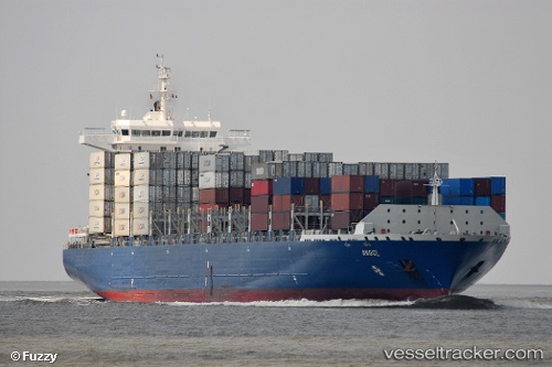
 RIYADH MUKAAB
Current Status
Where is the vessel?
RIYADH MUKAAB is currently in 20 nm S of Al Mukha, based on AIS data received less than 1h ago.
Latest AIS update:
Current position: 13.00642° N, 43.13520° E (20 nm S of Al Mukha)
Average speed (last 7 days): Loading…
Average speed (last 30 days): Loading…
Vessel profile: RIYADH MUKAAB is a Container Ship with dimensions m x m.
This page combines live AIS, route history, probable destination signals, nearby traffic, and port activity for practical vessel monitoring.
The current position of vessel RIYADH MUKAAB is 13.00642 lat / 43.13520 lng. Updated: 2026-04-23 08:59:40 UTCNearest reference points:
- Near Djibouti
Currently sailing under the flag of Liberia ![]()
Details:
Live Vessel RIYADH MUKAAB Analytics (details, animations, etc.)
Recent AIS points (UTC):
2026-04-23 05:11:15 UTC · 13.76108, 42.43803 · SOG 15.2 kn · COG 147°2026-04-23 07:30:10 UTC · 13.31763, 42.86818 · SOG 16.9 kn · COG 124°
2026-04-23 07:50:43 UTC · 13.26011, 42.94977 · SOG 17.5 kn · COG 134°
2026-04-23 08:59:40 UTC · 13.00642, 43.13520 · SOG 16.7 kn · COG 153°