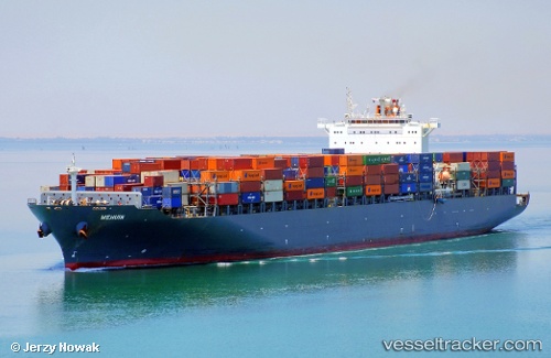
Mehuin
Current StatusWhere is the vessel?
Mehuin is currently in 40 nm E of JINHAI HEAVY INDUSTR, based on AIS data received about 14h ago.
Latest AIS update:
Current position: 30.13206° N, 123.01702° E (40 nm E of JINHAI HEAVY INDUSTR)
Average speed (last 7 days): Loading…
Average speed (last 30 days): Loading…
Vessel profile: Mehuin is a Container Ship with dimensions 40m x 306m.
This page combines live AIS, route history, probable destination signals, nearby traffic, and port activity for practical vessel monitoring.
The current position of vessel Mehuin is 30.13206 lat / 123.01702 lng. Updated: 2026-05-23 11:00:59 UTCNearest reference points:
- 44 nm E of JINHAI HEAVY INDUSTR
- 40 nm E of JINHAI HEAVY INDUSTR
- 45 nm E of JINHAI HEAVY INDUSTR
Details:
Live Vessel Mehuin Analytics (details, animations, etc.)
Recent AIS points (UTC):
2026-05-23 07:02:17 UTC · 29.65178, 122.71824 · SOG 13.5 kn · COG 91°2026-05-23 07:33:18 UTC · 29.65262, 122.84113 · SOG 10.6 kn · COG 75°
2026-05-23 09:57:45 UTC · 30.00949, 122.97020 · SOG 7.5 kn · COG 11°
2026-05-23 11:00:59 UTC · 30.13206, 123.01702 · SOG 9.2 kn · COG 60°