 vesseltracker.com
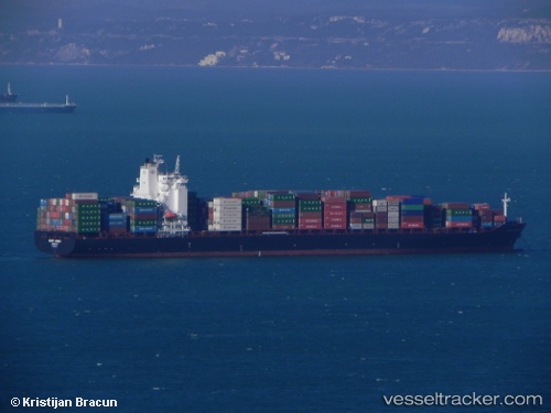
 FORT DESAIX
Current Status
Where is the vessel?
FORT DESAIX is currently in 85 nm S of Hettimulla, based on AIS data received less than 1h ago.
Latest AIS update:
Current position: 5.86498° N, 79.83588° W (85 nm S of Hettimulla)
Average speed (last 7 days): Loading…
Average speed (last 30 days): Loading…
Vessel profile: FORT DESAIX is a Container Ship with dimensions 32m x 269m.
This page combines live AIS, route history, probable destination signals, nearby traffic, and port activity for practical vessel monitoring.
The current position of vessel FORT DESAIX is 5.86498 lat / -79.83588 lng. Updated: 2026-05-14 11:20:53 UTCNearest reference points:
- 20 nm S of El Puerto
- 30 nm E of El Cirial (Isla Iguana)
- 33 nm W of Buenaventura
Currently sailing under the flag of Malta ![]()
FORT DESAIX built in 2010 year
Deadweight:
52788 tDetails:
Live Vessel FORT DESAIX Analytics (details, animations, etc.)
Recent AIS points (UTC):
2026-05-14 07:59:19 UTC · 5.20531, -80.02041 · SOG 12.7 kn · COG 13°2026-05-14 10:20:19 UTC · 5.67066, -79.88082 · SOG 11.9 kn · COG 11°
2026-05-14 10:20:19 UTC · 5.67066, -79.88082 · SOG 11.9 kn · COG 11°
2026-05-14 11:20:53 UTC · 5.86498, -79.83588 · SOG 12.2 kn · COG 11°