 vesseltracker.com
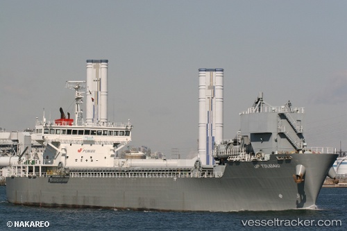
 Jp Tsubaki
Current Status
Where is the vessel?
Jp Tsubaki is currently in Near Naka-Ku, Kanagawa, based on AIS data received about 2h ago.
Latest AIS update:
Current position: 35.40155° N, 139.64223° E (Near Naka-Ku, Kanagawa)
Average speed (last 7 days): Loading…
Average speed (last 30 days): Loading…
Vessel profile: Jp Tsubaki is a Self Discharging Bulk Carrier with dimensions 115m x 20m.
This page combines live AIS, route history, probable destination signals, nearby traffic, and port activity for practical vessel monitoring.
The current position of vessel Jp Tsubaki is 35.40155 lat / 139.64223 lng. Updated: 2026-05-14 07:50:25 UTCNearest reference points:
- Near Naka-Ku, Kanagawa
- Near Yokohama
- Near Kawasaki
Currently sailing under the flag of Japan ![]()
Jp Tsubaki built in 2008 year
Deadweight:
6600 tDetails:
Live Vessel Jp Tsubaki Analytics (details, animations, etc.)
Recent AIS points (UTC):
2026-05-14 04:26:33 UTC · 35.40472, 139.66652 · SOG 0 kn · COG 44°2026-05-14 06:29:25 UTC · 35.40158, 139.64227 · SOG 0 kn · COG 76°
2026-05-14 07:35:25 UTC · 35.40157, 139.64224 · SOG 0 kn · COG 76°
2026-05-14 07:50:25 UTC · 35.40155, 139.64223 · SOG 0 kn · COG 76°