 vesseltracker.com
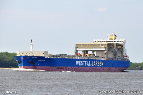
 PANAMANA
Current Status
Where is the vessel?
PANAMANA is currently in 122 nm NE of Las Brujas, based on AIS data received less than 1h ago.
Latest AIS update:
Current position: 25.44490° N, 17.35777° W (122 nm NE of Las Brujas)
Average speed (last 7 days): Loading…
Average speed (last 30 days): Loading…
Vessel profile: PANAMANA is a General Cargo Ship with dimensions 32m x 213m.
This page combines live AIS, route history, probable destination signals, nearby traffic, and port activity for practical vessel monitoring.
The current position of vessel PANAMANA is 25.44490 lat / -17.35777 lng. Updated: 2026-05-14 11:28:04 UTCNearest reference points:
- 110 nm NE of Las Brujas
- 68 nm NW of Ad Dakhla
- 22 nm S of San Agustin
Currently sailing under the flag of Norway (NIS) ![]()
PANAMANA built in 2010 year
Deadweight:
54810 tDetails:
Live Vessel PANAMANA Analytics (details, animations, etc.)
Recent AIS points (UTC):
2026-05-14 07:23:00 UTC · 26.37500, -17.02167 · SOG 13 kn · COG -1°2026-05-14 09:40:59 UTC · 25.85667, -17.20167 · SOG 15 kn · COG -1°
2026-05-14 10:37:59 UTC · 25.62667, -17.28833 · SOG 13 kn · COG -1°
2026-05-14 11:28:04 UTC · 25.44490, -17.35777 · SOG 14 kn · COG 199°