 vesseltracker.com
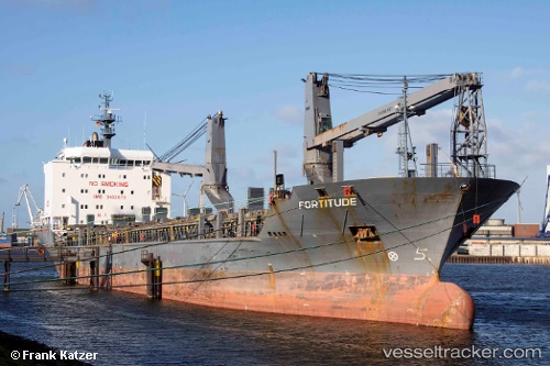
 UAL FORTITUDE
Current Status
Where is the vessel?
UAL FORTITUDE is currently in 227 nm SW of Cap Skiring, based on AIS data received about 1h ago.
Latest AIS update:
Current position: 9.96167° N, 19.70833° W (227 nm SW of Cap Skiring)
Average speed (last 7 days): Loading…
Average speed (last 30 days): Loading…
Vessel profile: UAL FORTITUDE is a General Cargo Ship with dimensions 21m x 139m.
This page combines live AIS, route history, probable destination signals, nearby traffic, and port activity for practical vessel monitoring.
The current position of vessel UAL FORTITUDE is 9.96167 lat / -19.70833 lng. Updated: 2026-04-28 19:49:35 UTCNearest reference points:
- 144 nm SW of Bubaque
- Open sea, approx. 400 nm off the nearest listed port
- Open sea, approx. 402 nm off the nearest listed port
Currently sailing under the flag of Portugal (MAR) ![]()
UAL FORTITUDE built in 2008 year
Deadweight:
12638 tDetails:
Live Vessel UAL FORTITUDE Analytics (details, animations, etc.)
Recent AIS points (UTC):
2026-04-28 15:37:35 UTC · 10.41833, -20.46666 · SOG 12 kn · COG -1°2026-04-28 16:22:53 UTC · 10.33814, -20.33181 · SOG 12.3 kn · COG 118°
2026-04-28 17:46:32 UTC · 10.18500, -20.08000 · SOG 12 kn · COG -1°
2026-04-28 19:49:35 UTC · 9.96167, -19.70833 · SOG 12 kn · COG -1°