 vesseltracker.com
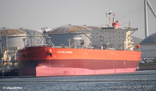
 VELOS EMERALD
Current Status
Where is the vessel?
VELOS EMERALD is currently in 30 nm N of Doraleh Container Terminal, based on AIS data received less than 1h ago.
Latest AIS update:
Current position: 12.07732° N, 44.45262° E (30 nm N of Doraleh Container Terminal)
Average speed (last 7 days): Loading…
Average speed (last 30 days): Loading…
Vessel profile: VELOS EMERALD is a Crude Oil Tanker with dimensions 244m x 244m.
This page combines live AIS, route history, probable destination signals, nearby traffic, and port activity for practical vessel monitoring.
The current position of vessel VELOS EMERALD is 12.07732 lat / 44.45262 lng. Updated: 2026-05-14 06:13:11 UTCNearest reference points:
- Near Djibouti
Currently sailing under the flag of Marshall Islands ![]()
VELOS EMERALD built in 2008 year
Deadweight:
115042 tDetails:
Live Vessel VELOS EMERALD Analytics (details, animations, etc.)
Recent AIS points (UTC):
2026-05-14 02:56:22 UTC · 12.36080, 43.84197 · SOG 11.7 kn · COG 114°2026-05-14 04:00:51 UTC · 12.27263, 44.03952 · SOG 12.1 kn · COG 117°
2026-05-14 05:03:12 UTC · 12.17985, 44.23385 · SOG 12.2 kn · COG 117°
2026-05-14 06:13:11 UTC · 12.07732, 44.45262 · SOG 12.2 kn · COG 113°