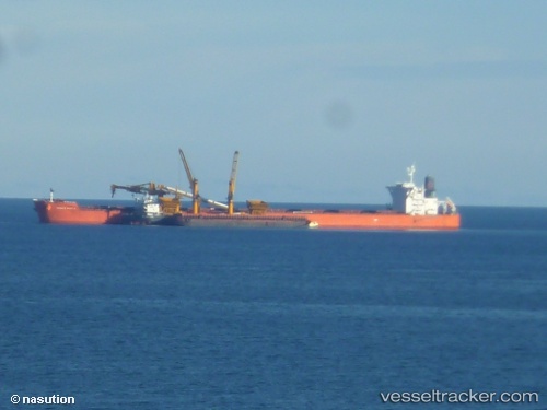
.
Vessel photo of DUKESHIP (IMO 9402304) vesseltracker.com

MH flag DUKESHIP

Vessel type: Bulk Carrier | IMO: 9402304 | MMSI: MMSI: 538009710
Call sign: V7A5072 | Dimensions: 45 m x 292 m
Current Status

Where is the vessel?

DUKESHIP is currently in Near JINHAI HEAVY INDUSTR, based on AIS data received about 1h ago.

Latest AIS update:

Current position: 30.15070° N, 122.28020° E (Near JINHAI HEAVY INDUSTR)

Average speed (last 7 days): Loading…

Average speed (last 30 days): Loading…

Vessel profile: DUKESHIP is a Bulk Carrier with dimensions 45m x 292m.

This page combines live AIS, route history, probable destination signals, nearby traffic, and port activity for practical vessel monitoring.

The current position of vessel DUKESHIP is 30.15070 lat / 122.28020 lng. Updated: 2026-04-28 22:59:28 UTC
Nearest reference points:
  • Near ZHOUSHAN
  • Near JINHAI HEAVY INDUSTR
  • Near Majistan/Zhoushan

Currently sailing under the flag of Marshall Islands MH flag

DUKESHIP built in 2010 year

Deadweight:
181453 t

Details:

Live Vessel DUKESHIP Analytics (details, animations, etc.)


Recent AIS points (UTC):
2026-04-28 17:44:28 UTC · 30.14815, 122.28610 · SOG 0 kn · COG 327°
2026-04-28 20:11:25 UTC · 30.14842, 122.28100 · SOG 0 kn · COG 70°
2026-04-28 21:56:25 UTC · 30.14993, 122.28022 · SOG 0 kn · COG 95°
2026-04-28 22:59:28 UTC · 30.15070, 122.28020 · SOG 0 kn · COG 105°

Track of the vessel in the last 60 days


UTC: --
Start: -- Track timeline (UTC) End: --
Encountered: --


Link to the map:


Find another ship

DUKESHIP (538009710) last ports (portcalls and passsages)

Manjung | 2025-09-15 13:21:22
Pangkur | 2025-09-14 11:41:22
Changi | 2025-09-08 11:06:16
DONGJIAKOU | 2025-08-14 00:41:41
Selat Lombok | 2025-07-29 23:14:20
Dampier | 2025-07-25 06:12:10
Rizhao | 2025-06-25 23:07:56
Selat Lombok | 2025-06-13 15:42:21
PORT WALCOTT | 2025-06-08 13:44:38
Samson Point | 2025-06-08 13:06:13
HUANGHUA | 2025-05-22 03:08:43
PENGERANG | 2025-05-01 12:52:38
TANAH MERAH | 2025-04-30 22:28:05
BATU AMPAR | 2025-04-30 21:29:38
PULAU SAMBU | 2025-04-30 20:23:57
Saldanha Bay | 2025-04-05 04:02:14
SALDANHA | 2025-04-04 18:43:00
SALDANHA | 2025-03-31 18:27:00
Saldanha Bay | 2025-03-31 14:02:50
DHAMRA | 2025-03-07 10:15:52
PULAU SAMBU | 2025-03-01 03:35:45
TANAH MERAH | 2025-02-28 01:42:42
PENGERANG | 2025-02-28 00:55:25
GLADSTONE | 2025-02-09 01:58:19
GLADSTONE | 2025-02-05 01:26:39
ZHOUSHAN | 2024-12-25 02:32:13
BATU AMPAR | 2024-12-11 13:43:50
PULAU SAMBU | 2024-12-11 12:51:46
Sept Iles | 2024-10-16 23:36:12
Bishop Rock | 2024-10-05 05:25:49
Saldanha Bay | 2024-08-24 21:07:27
Sambu | 2024-07-30 23:20:28
Singapore | 2024-07-30 00:21:24
Fangcheng | 2024-07-17 06:43:39
Singapore | 2024-04-23 10:56:49
Fangcheng | 2024-04-09 01:47:36
Singapore | 2024-04-03 03:26:43
Sambu | 2024-04-03 02:46:02
Singapore | 2024-01-13 22:21:54
Samson Point | 2023-11-15 16:13:39
Jingjiang | 2023-11-02 11:04:11
Taicang | 2023-10-31 10:20:22
Wusong | 2023-10-31 05:43:51
Selat Lombok | 2023-10-17 00:31:50
Dampier | 2023-10-12 03:59:11
Selat Lombok | 2023-10-05 19:14:49
Rizhao | 2023-09-22 02:23:26
Singapore | 2023-09-11 10:33:56
Sambu | 2023-09-02 16:41:53
Nantong | 2023-08-23 09:46:22
Zhangjiagang | 2023-08-21 07:52:08
Taicang | 2023-08-21 00:55:24
Wusong | 2023-08-20 06:22:51
Jingjiang | 2023-08-20 00:50:57
Singapore | 2023-08-07 01:30:33
Port Louis | 2023-06-02 02:18:24
Dagu Bar | 2023-01-11 11:52:53