 vesseltracker.com
Atlantic T
Current StatusWhere is the vessel?
Atlantic T is currently in 27 nm N of Uiryeong-gun, based on AIS data received less than 1h ago.
Latest AIS update:
Current position: 25.74203° N, 128.39832° E (27 nm N of Uiryeong-gun)
Average speed (last 7 days): Loading…
Average speed (last 30 days): Loading…
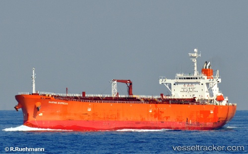
Vessel profile: Atlantic T is a Oil Products Tanker with dimensions 33m x 180m.
This page combines live AIS, route history, probable destination signals, nearby traffic, and port activity for practical vessel monitoring.
The current position of vessel Atlantic T is 25.74203 lat / 128.39832 lng. Updated: 2026-05-13 23:57:26 UTCNearest reference points:
- 77 nm SE of Miyakojima
Details:
Live Vessel Atlantic T Analytics (details, animations, etc.)
Recent AIS points (UTC):
2026-05-13 18:43:51 UTC · 25.08556, 127.37138 · SOG 14 kn · COG 45°2026-05-13 21:24:38 UTC · 25.53340, 127.84798 · SOG 13.9 kn · COG 49°
2026-05-13 22:04:53 UTC · 25.63932, 127.97010 · SOG 13.5 kn · COG 54°
2026-05-13 23:57:26 UTC · 25.74203, 128.39832 · SOG 13 kn · COG 79°