 vesseltracker.com
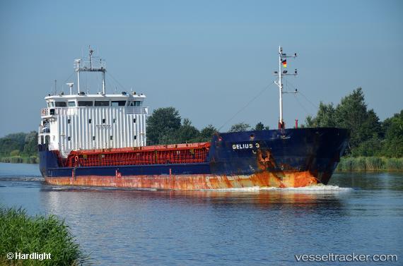
 GELMOND 3
Current Status
Where is the vessel?
GELMOND 3 is currently in 100 nm N of Maials, based on AIS data received about 6h ago.
Latest AIS update:
Current position: 42.98045° N, 30.74867° E (100 nm N of Maials)
Average speed (last 7 days): Loading…
Average speed (last 30 days): Loading…
Vessel profile: GELMOND 3 is a General Cargo Ship with dimensions 89m x 15m.
This page combines live AIS, route history, probable destination signals, nearby traffic, and port activity for practical vessel monitoring.
The current position of vessel GELMOND 3 is 42.98045 lat / 30.74867 lng. Updated: 2026-05-14 02:45:35 UTCNearest reference points:
- 54 nm SE of Sveti Nikola
- 45 nm N of RUMELI FENERI
- Near Erdemir
Currently sailing under the flag of St.Kitts and Nevis ![]()
GELMOND 3 built in 2008 year
Deadweight:
5492 tDetails:
Live Vessel GELMOND 3 Analytics (details, animations, etc.)
Recent AIS points (UTC):
2026-05-14 02:45:35 UTC · 42.98045, 30.74867 · SOG 8.2 kn · COG 256°2026-05-14 02:45:35 UTC · 42.98045, 30.74867 · SOG 8.2 kn · COG 256°
2026-05-14 02:45:35 UTC · 42.98045, 30.74867 · SOG 8.2 kn · COG 256°
2026-05-14 02:45:35 UTC · 42.98045, 30.74867 · SOG 8.2 kn · COG 256°