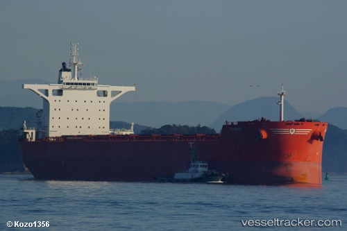
.
Vessel photo of Taurus (IMO 9403530) vesseltracker.com

Taurus

Vessel type: Bulk Carrier | IMO: 9403530 | MMSI: MMSI: 235074621
Call sign: 2CPB4 | Dimensions: 45 m x 292 m
Current Status

Where is the vessel?

Taurus is currently in 167 nm N of Sainte-Marie, based on AIS data received about 1h ago.

Latest AIS update:

Current position: 18.10261° S, 55.34994° E (167 nm N of Sainte-Marie)

Average speed (last 7 days): Loading…

Average speed (last 30 days): Loading…

Vessel profile: Taurus is a Bulk Carrier with dimensions 45m x 292m.

This page combines live AIS, route history, probable destination signals, nearby traffic, and port activity for practical vessel monitoring.

The current position of vessel Taurus is -18.10261 lat / 55.34994 lng. Updated: 2026-05-16 16:21:39 UTC
Nearest reference points:
  • 164 nm NW of Pointe aux Canonniers
  • Near Port Louis
Details:

Live Vessel Taurus Analytics (details, animations, etc.)


Recent AIS points (UTC):
2026-05-16 12:58:36 UTC · -17.71510, 55.79912 · SOG 10.4 kn · COG 221°
2026-05-16 13:44:30 UTC · -17.80333, 55.69667 · SOG 10 kn · COG -1°
2026-05-16 16:05:34 UTC · -18.07333, 55.38500 · SOG 10 kn · COG -1°
2026-05-16 16:21:39 UTC · -18.10261, 55.34994 · SOG 9.7 kn · COG 225°

Track of the vessel in the last 60 days


UTC: --
Start: -- Track timeline (UTC) End: --
Encountered: --


Link to the map:


Find another ship

Taurus (235074621) last ports (portcalls and passsages)

West Coast Town | 2025-09-14 11:41:22
Dung Quat Petroleum Port | 2025-08-09 00:07:57
DUNG QUAT | 2025-08-08 16:19:17
PENGERANG | 2025-08-04 21:02:19
BATU AMPAR | 2025-08-04 20:02:00
PANGKOR | 2025-08-01 08:47:30
PULAU SAMBU | 2025-07-31 03:12:18
TANAH MERAH | 2025-07-31 02:07:24
Taicang | 2025-04-15 19:19:08
Wusong | 2025-04-15 18:09:32
Jingjiang | 2025-04-15 12:16:55
PENGERANG | 2025-03-29 05:18:19
TANAH MERAH | 2025-03-29 04:02:10
PULAU SAMBU | 2025-03-29 02:54:46
Richards Bay | 2025-03-02 03:52:57
Maputo | 2025-02-28 23:08:03
Maputo | 2025-02-24 22:46:56
JURONG ISLAND | 2025-02-08 00:18:01
PULAU SAMBU | 2025-02-07 23:01:32
TANAH MERAH | 2025-02-06 11:58:42
PENGERANG | 2025-02-06 11:17:13
GUISHAN | 2024-12-31 13:01:50
Nansha | 2024-12-31 10:30:15
HUANGPU | 2024-12-29 05:18:52
DONG GUAN | 2024-12-29 03:30:06
Guangzhou | 2024-12-29 02:57:09
GUISHAN | 2024-12-25 09:37:41
Port Headland | 2024-12-11 20:51:04
Selat Lombok | 2024-12-07 07:29:43
JINGTANG | 2024-11-23 10:10:32
Selat Lombok | 2024-11-03 15:25:32
Port Headland | 2024-10-29 16:44:15
Rizhao | 2024-10-10 02:09:50
Selat Lombok | 2024-09-27 13:25:35
Port Headland | 2024-09-22 20:49:54
Bayuquan | 2024-08-31 17:43:32
Port Headland | 2024-08-13 08:57:05
Selat Lombok | 2024-08-08 23:36:05
Bayuquan | 2024-07-25 09:14:15
Lianyungang | 2024-07-19 19:04:17
Port Headland | 2024-07-03 17:11:10
Selat Lombok | 2024-05-27 18:27:49
Port Headland | 2024-05-23 03:09:43
Selat Lombok | 2024-05-17 18:13:24
Selat Lombok | 2024-04-22 08:50:13
Port Headland | 2024-04-18 03:26:42
Selat Lombok | 2024-04-12 00:59:44
Caldera | 2024-02-07 20:13:49
Tsugaru-Kaikyo | 2023-09-25 09:08:25
Rizhao | 2023-09-13 22:09:12
Sambu | 2023-05-28 10:28:21
Sriracha | 2023-05-22 10:09:51
Sriracha | 2023-05-18 10:04:32
Newcastle | 2023-04-27 22:47:21
Wusong | 2023-04-05 04:05:28
Saldanha Bay | 2023-02-18 05:12:47
Sambu | 2023-01-21 08:18:59
Ta-Ku | 2023-01-08 17:50:57
Ta-Ku | 2023-01-04 17:34:08
Taku Bar | 2023-01-04 14:46:47
Strait Of Gibraltar | 2022-09-18 01:03:37
Port Said | 2022-09-08 16:51:28
Bur Ibrahim | 2022-09-08 07:03:34
Ra’S Shukhayr | 2022-09-06 22:56:26
Selat Lombok | 2022-06-20 22:12:17
Samson Point | 2022-06-16 10:40:20
Samson Point | 2022-06-12 10:35:49
Samson Point | 2022-06-08 10:33:54
Samson Point | 2022-06-04 07:43:50
Samson Point | 2022-05-31 07:41:13
Samson Point | 2022-05-27 07:22:47
Selat Lombok | 2022-05-24 10:47:04