 vesseltracker.com
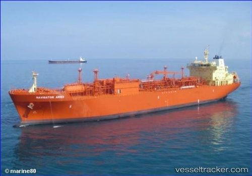
 NAVIGATOR ARIES
Current Status
Where is the vessel?
NAVIGATOR ARIES is currently in 135 nm E of Parelhas, based on AIS data received less than 1h ago.
Latest AIS update:
Current position: 6.43628° N, 34.40829° W (135 nm E of Parelhas)
Average speed (last 7 days): Loading…
Average speed (last 30 days): Loading…
Vessel profile: NAVIGATOR ARIES is a Lpg Tanker with dimensions m x m.
This page combines live AIS, route history, probable destination signals, nearby traffic, and port activity for practical vessel monitoring.
The current position of vessel NAVIGATOR ARIES is 6.43628 lat / -34.40829 lng. Updated: 2026-05-16 11:35:48 UTCCurrently sailing under the flag of Liberia ![]()
Details:
Live Vessel NAVIGATOR ARIES Analytics (details, animations, etc.)
Recent AIS points (UTC):
2026-05-16 07:59:53 UTC · 6.10185, -33.62510 · SOG 14.3 kn · COG 296°2026-05-16 10:07:59 UTC · 6.30414, -34.09271 · SOG 14.2 kn · COG 296°
2026-05-16 10:43:32 UTC · 6.35951, -34.21989 · SOG 14.1 kn · COG 293°
2026-05-16 11:35:48 UTC · 6.43628, -34.40829 · SOG 14.2 kn · COG 294°