 vesseltracker.com
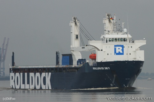
 Rolldock Sky
Current Status
Where is the vessel?
Rolldock Sky is currently in 86 nm NW of Tortella, based on AIS data received about 1h ago.
Latest AIS update:
Current position: 43.45167° N, 27.81833° W (86 nm NW of Tortella)
Average speed (last 7 days): Loading…
Average speed (last 30 days): Loading…
Vessel profile: Rolldock Sky is a Heavy Load Carrier with dimensions 141m x 24m.
This page combines live AIS, route history, probable destination signals, nearby traffic, and port activity for practical vessel monitoring.
The current position of vessel Rolldock Sky is 43.45167 lat / -27.81833 lng. Updated: 2026-05-14 16:03:49 UTCCurrently sailing under the flag of Netherlands ![]()
Details:
Live Vessel Rolldock Sky Analytics (details, animations, etc.)
Recent AIS points (UTC):
2026-05-14 13:27:26 UTC · 43.66833, -27.10667 · SOG 13 kn · COG -1°2026-05-14 13:45:25 UTC · 43.64333, -27.18833 · SOG 13 kn · COG -1°
2026-05-14 16:00:50 UTC · 43.45667, -27.80500 · SOG 13 kn · COG -1°
2026-05-14 16:03:49 UTC · 43.45167, -27.81833 · SOG 13 kn · COG -1°