 vesseltracker.com
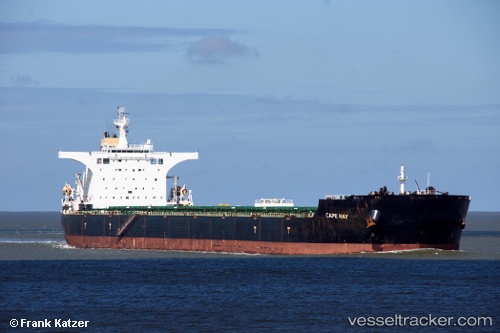
 CAPE RAY
Current Status
Where is the vessel?
CAPE RAY is currently in 15 nm E of Xiangzhi, based on AIS data received about 4h ago.
Latest AIS update:
Current position: 24.75266° N, 119.03388° E (15 nm E of Xiangzhi)
Average speed (last 7 days): Loading…
Average speed (last 30 days): Loading…
Vessel profile: CAPE RAY is a Bulk Carrier with dimensions 292m x 45m.
This page combines live AIS, route history, probable destination signals, nearby traffic, and port activity for practical vessel monitoring.
The current position of vessel CAPE RAY is 24.75266 lat / 119.03388 lng. Updated: 2026-05-14 23:41:55 UTCNearest reference points:
- 13 nm E of Xiangzhi
- 17 nm E of Xiangzhi
- 12 nm NE of Xiangzhi
Currently sailing under the flag of Marshall Islands ![]()
CAPE RAY built in 2007 year
Deadweight:
177853 tDetails:
Live Vessel CAPE RAY Analytics (details, animations, etc.)
Recent AIS points (UTC):
2026-05-14 20:14:54 UTC · 24.75321, 119.03657 · SOG 0.1 kn · COG 260°2026-05-14 22:05:58 UTC · 24.75329, 119.03589 · SOG 0.1 kn · COG 177°
2026-05-14 22:26:58 UTC · 24.75367, 119.03577 · SOG 0 kn · COG 170°
2026-05-14 23:41:55 UTC · 24.75266, 119.03388 · SOG 0.1 kn · COG 114°