 vesseltracker.com
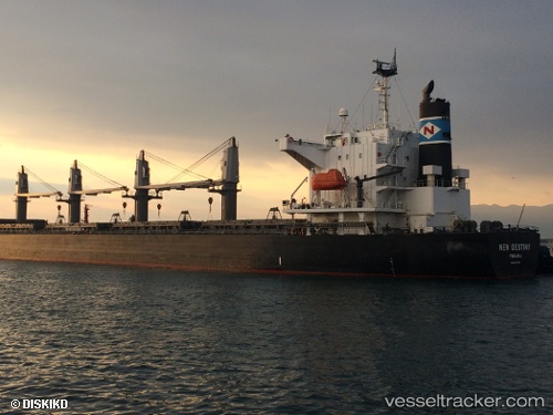
 SUN SHINE
Current Status
Where is the vessel?
SUN SHINE is currently in 26 nm E of Leuwiliang, based on AIS data received about 13h ago.
Latest AIS update:
Current position: 6.65386° N, 107.05129° E (26 nm E of Leuwiliang)
Average speed (last 7 days): Loading…
Average speed (last 30 days): Loading…
Vessel profile: SUN SHINE is a Bulk Carrier with dimensions m x m.
This page combines live AIS, route history, probable destination signals, nearby traffic, and port activity for practical vessel monitoring.
The current position of vessel SUN SHINE is 6.65386 lat / 107.05129 lng. Updated: 2026-05-14 17:00:50 UTCNearest reference points:
- 36 nm SW of Slipi
- 11 nm N of Gombong
- 50 nm SW of Ben Dam Con Dao Terminals
Currently sailing under the flag of Marshall Islands ![]()
Details:
Live Vessel SUN SHINE Analytics (details, animations, etc.)
Recent AIS points (UTC):
2026-05-14 17:00:50 UTC · 6.65386, 107.05129 · SOG 11.5 kn · COG 204°2026-05-14 17:00:50 UTC · 6.65386, 107.05129 · SOG 11.5 kn · COG 204°
2026-05-14 17:00:50 UTC · 6.65386, 107.05129 · SOG 11.5 kn · COG 204°
2026-05-14 17:00:50 UTC · 6.65386, 107.05129 · SOG 11.5 kn · COG 204°