 vesseltracker.com
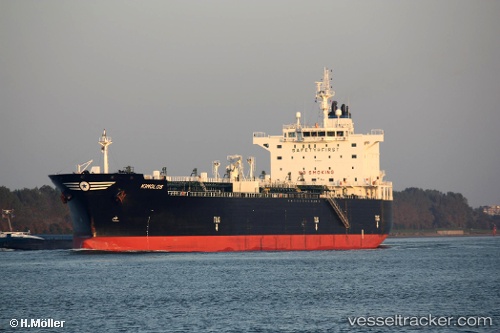
 ZEVULUN
Current Status
Where is the vessel?
ZEVULUN is currently in 102 nm S of Port Eads, based on AIS data received about 2h ago.
Latest AIS update:
Current position: 27.38368° N, 88.59226° W (102 nm S of Port Eads)
Average speed (last 7 days): Loading…
Average speed (last 30 days): Loading…
Vessel profile: ZEVULUN is a Oil/Chemical Tanker with dimensions m x m.
This page combines live AIS, route history, probable destination signals, nearby traffic, and port activity for practical vessel monitoring.
The current position of vessel ZEVULUN is 27.38368 lat / -88.59226 lng. Updated: 2026-05-16 01:18:20 UTCNearest reference points:
- Near Pilottown
- 13 nm NE of Pilottown
- Near Port Fourchon
Currently sailing under the flag of Liberia ![]()
Details:
Live Vessel ZEVULUN Analytics (details, animations, etc.)
Recent AIS points (UTC):
2026-05-15 19:37:18 UTC · 28.55185, -89.25317 · SOG 13.3 kn · COG 152°2026-05-15 19:37:18 UTC · 28.55185, -89.25317 · SOG 13.3 kn · COG 152°
2026-05-16 01:18:20 UTC · 27.38368, -88.59226 · SOG 13.8 kn · COG 155°
2026-05-16 01:18:20 UTC · 27.38368, -88.59226 · SOG 13.8 kn · COG 155°